
Walk a St. Cloud Street
A sound street directory search moves from the modern address to durable land identifiers, then adds evidence in layers. The Property Appraiser identifies the parcel and current owner. GIS places that parcel among its neighbors. Official Records shows conveyances and liens. City or county permit files add work history. Voter and reverse-directory material have different access rules and cannot be treated as a full household list.
Begin with one known address rather than the street name alone. Confirm the street suffix and direction, especially on the old grid. Save the parcel ID and legal description for each result. These values prevent a corner lot, alternate address, trust name, or changed street text from breaking the chain.
- Enter the situs address in the Osceola Property Appraiser search.
- Read the result's jurisdiction, parcel ID, owner, legal description, and map link.
- Use GIS to click the next parcel along the same side of the street.
- Follow sales references and party names into the Clerk's deed index.
- Add permit, code, lawful voter, or verified historical-directory evidence as the question requires.
St. Cloud Street Search Fields
The Osceola County Property Appraiser provides a free roll search. An address query returns land records, not a promise about every resident. Partial street text may retrieve several parcels. An owner query may bring up a trust or company, while the parcel number leads back to the exact tract.
| Field | Input | Street-directory use |
|---|---|---|
| Owner Name | Person, trust, or entity text | Find parcels under a recorded owner variant |
| Address | Situs address or partial street | Open one parcel or scan matching parcels |
| Parcel Number | County PID or folio | Return to the exact parcel without name ambiguity |
| Subdivision | Platted development | Group lots with a common plat |
| Property Use | Use category | Separate residential, vacant, and other land |
| Jurisdiction | Result or filter | Distinguish St. Cloud from Osceola County |
A parcel card may display situs and mailing addresses, legal description, land use, exemptions, values, sales, building facts, sketch, photo, and map link. Mailing is where a tax notice goes. It may be a post office box or an out-of-area address, so do not mistake it for the parcel location.
Map St. Cloud Streets by Parcel
The free Osceola GIS map turns a list of search results into a street view of parcel boundaries. Search or select an address, zoom to the lot, and click adjacent shapes. Published layers may add aerial imagery, municipal limits, subdivisions, roads, zoning, future land use, flood context, districts, and service areas. A map layer is informative, not a boundary survey.
The current GIS viewer assigned to the St. Cloud street directory is pictured here. Open the Osceola map source before working along the block.
The visible parcel shapes help catch corner lots, cross-street addresses, common areas, and gaps that a text result list can hide.
Advance one parcel at a time and record the PID. A street name may continue across a city-limit line, yet permit and code custody can switch at that line. The jurisdiction shown by the parcel system decides whether the City of St. Cloud or Osceola County is the right next office.
St. Cloud Records by Address
No single St. Cloud street directory covers all relationships to an address. The strongest result comes from joining sources by parcel ID, legal description, instrument number, and date. Each source answers a narrow question and has its own online, counter, mail, phone, or records-request fallback.
| Address record | Keeper | What it can show | Access |
|---|---|---|---|
| Property roll | Osceola Property Appraiser | Owner, situs, mail, PID, legal description, sales | Free portal and office help |
| GIS parcel map | Osceola County | Parcel position, adjacent lots, jurisdiction, layers | Free viewer |
| Deeds and liens | Osceola Clerk | Parties, legal description, dates, recording references | PERCH, Historical Index, courthouse, Records Center |
| Plats | Clerk and GIS | Subdivision, lot, block, roads, easements | Index and copies; plat copy fee applies |
| Permits | City or county | Work, applicant, contractor, issue and status | Portal or research request |
| Code cases | City or county compliance | Address, notice, responsible party, case status | Department or public-record request |
Voter information is different. Florida's own-record status lookup needs first name, last name, birth date, and acknowledgment. It cannot browse a street. A lawful voter extract follows the Division of Elections request process, excludes protected fields, and should not be represented as an all-resident list.
Postal St. Cloud Versus City
A mailing label that says St. Cloud can extend beyond incorporated St. Cloud into unincorporated Osceola County. This geography is the most important local check in any by-address search. The city's Building Department tells users to enter the address in the Property Appraiser system and confirm that the result says “St. Cloud.” A result marked “Osceola County” belongs with county permitting, even when USPS accepts St. Cloud as the mailing city.
ZIP Codes 34769, 34771, 34772, and 34773 are delivery areas rather than municipal resident rolls. Annexation and growth to the east and south make a city name, ZIP, voting district, school zone, and permit jurisdiction separate layers. Verify the exact address with USPS when mail geography matters, then return to the parcel jurisdiction for government custody.
Key distinction. The situs address locates the parcel, the mailing address receives tax mail, and the legal description identifies the land in recorded instruments.
Deeds Along St. Cloud Streets
Open a parcel card's sale or instrument reference in the Osceola Clerk Official Records gateway. Search each name as grantor and grantee. Narrow common names by document type and recording date. A recorded entry may show instrument number, book and page, date and time, document type, parties, legal-description reference, pages, and an image or certification action.
Grantor means the person or entity transferring an interest. Grantee means the recipient. A deed image may also contain preparer and return-to information, mailing addresses, witnesses, notary, consideration, and the full legal description. These details concern the transaction. They do not prove that a named party occupied the property.
The public gateway does not state one universal online cutoff for every series. When an older index or image is absent, move to the Historical Records Index, call the Clerk at 407-742-3500, use the courthouse public channel, ask the off-site Records Center, or submit a JustFOIA request. Plat copies cost $5 per page plus $2 per instrument for certification. A free index screen and a certified copy serve different needs.
Note: Check the legal description at every transfer so a same-name seller does not lead the street search onto another parcel.
St. Cloud Permits by Address
The St. Cloud Building Department adds construction history after jurisdiction is confirmed. Its portal can search permit number or property address, check status and inspections, print documents, and handle payment. Staff research requires the Property Appraiser parcel or folio number plus the requested address, contact details, scope, and date or work description.
The assigned capture shows the city's permit and jurisdiction guidance. Read the St. Cloud permit source before choosing the online portal or staff request.
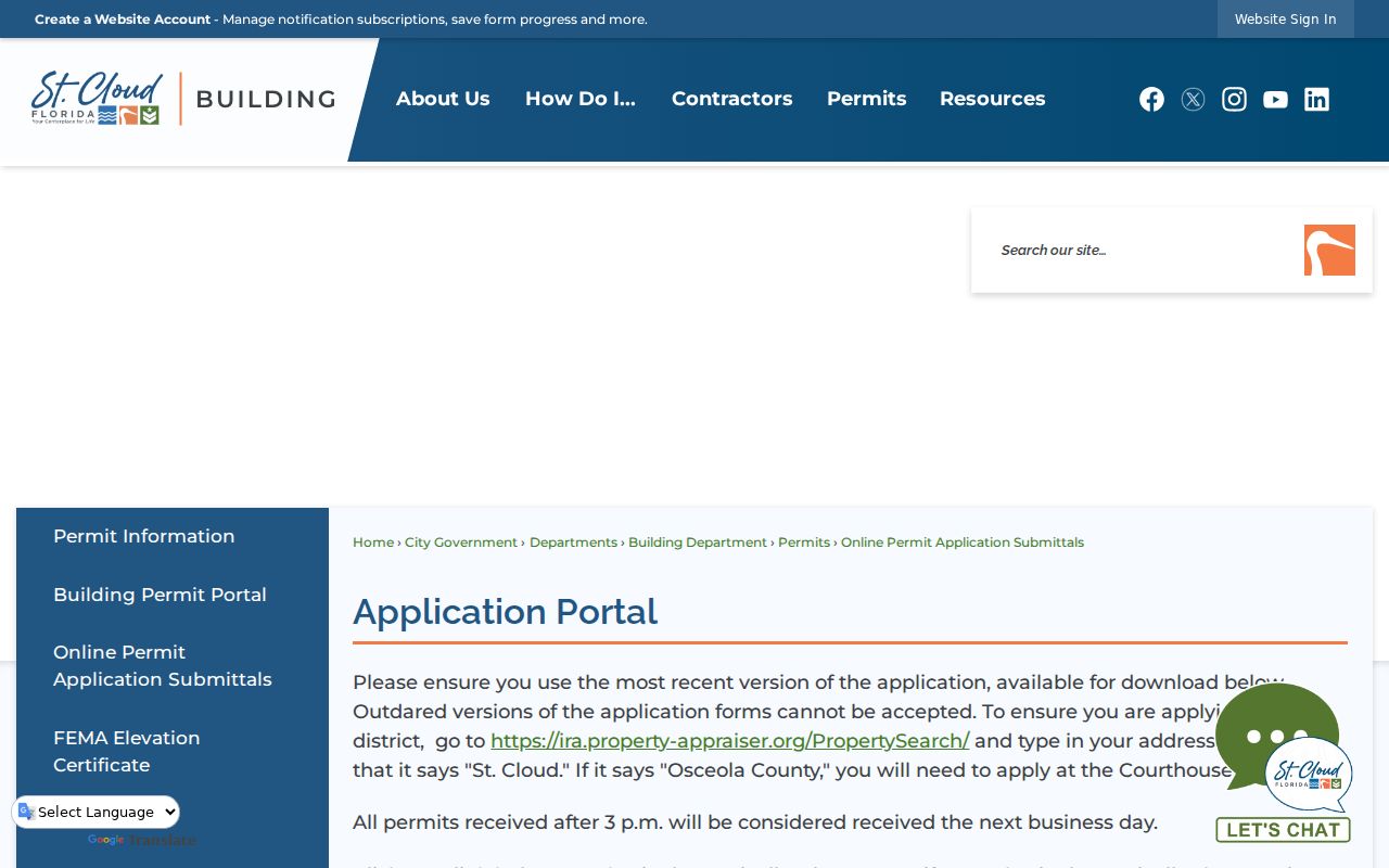
The city page reinforces the parcel-first test and lists the correct departmental channels.
The Building counter is at 1300 9th Street, Building A, first floor, weekdays from 8 a.m. to 4 p.m.; the phone is 407-957-7224. Applications arriving after 3 p.m. count as next-business-day receipts. Completed research material may appear under Attachments after applicable payment. Fence permitting moved to Community Development on February 1, 2025, so older and newer fence files may follow different routing.
St. Cloud's Address Grid
The historic core pairs numbered east-west streets with north-south avenues named for states, including Massachusetts, New York, Pennsylvania, and Florida. The pattern is easy to read on a map but can be hard to search in old print. Optical character recognition may confuse abbreviations such as “Mass Ave” and “Massachusetts Avenue.” Search both the abbreviated and full form, and try “Saint Cloud” as well as “St. Cloud” in catalogs.
The March 1924 Sanborn map has eight sheets showing structures, uses, materials, and street numbers. The city's 2024 Historic Preservation Plan supplies an address-level inventory with resource type and reported build year. Neither source is a resident list. Match a mapped building to deeds, public census schedules, and a directory edition whose year and publisher have been verified by a library.
- Parcel
- A mapped unit of land with its own county identifier.
- Situs address
- The address assigned to the physical parcel.
- Plat
- A recorded map that divides land into lots, blocks, roads, and easements.
- Criss-cross directory
- A directory arranged by address or telephone instead of surname.
Past St. Cloud Streets in Print
A verified reverse or criss-cross directory can identify the listed householder at an address for one publication year. The Osceola Library System, State Library of Florida, State Archives, and Osceola History are the proper channels. Ask reference staff for title, publisher, year run, missing years, address section, abbreviation key, and access format. The official web research did not confirm exact St. Cloud reverse-directory years, so do not assume an edition exists.
When an address disappears between editions, check street formatting, renumbering, demolition, annexation, a household move, or death before drawing a conclusion. The full shelf and catalog method is covered in the St. Cloud directory book research. The street directory uses that shelf only to add a dated occupant clue after the parcel chain is secure.
Limits of St. Cloud Street Records
Property ownership, homestead, and tax mail are clues, not a complete account of residence. A homestead exemption may support owner occupancy, but it does not identify every person in a home. Trusts, estates, companies, spouses, renters, relatives, and guests complicate any simple owner-to-resident claim. Utility customer data, driver records, confidential voter addresses, sealed files, and protected personal identifiers are not open household fields.
Florida's Address Confidentiality Program provides a substitute address and mail forwarding for qualifying survivors. Section 119.071 also protects specified data and addresses. Never infer a hidden address, publish a protected field, or confront someone based on a map or index. Ask the custodian to correct an error or review an exposed identifier.
Lawful use only. Use St. Cloud street directory records for legitimate personal, historical, property, or civic research. Stalking, harassment, intimidation, and harm are prohibited.
A responsible result states exactly what the source proves: a parcel owner, recorded party, permit applicant, or listed person in a dated edition. It does not turn that narrow fact into an unsupported claim about the whole household.