
St. Cloud ZIP Areas at Glance
Four mailing ZIPs commonly appear with St. Cloud addresses. They are delivery geographies, not lists of residents and not legal city boundaries. The descriptions below are practical orientations supported by the local research. Exact polygons, ZIP realignment dates, station assignments, and any special-use classification were not published in the inspected government sources, so the USPS ZIP Code Lookup remains the authority for one current address.
| ZIP | General area | Post office check | Research note |
|---|---|---|---|
| 34769 | Historic core and central St. Cloud mailing area | Verify the full address with USPS | Often associated with the older numbered-street and state-avenue grid |
| 34771 | North and east growth area | Verify the full address with USPS | Postal St. Cloud can extend beyond the incorporated city |
| 34772 | South and southwest delivery area | Verify the full address with USPS | City jurisdiction cannot be inferred from ZIP alone |
| 34773 | Far-eastern postal reach | Verify the full address with USPS | Delivery geography may include unincorporated Osceola County |
This St. Cloud ZIP code directory therefore uses careful area language. It does not assign a neighborhood, post office, or municipal status when official research did not establish one. A current USPS result answers the mailing question. The Property Appraiser answers the parcel and jurisdiction questions.
34769 and St. Cloud Records
The historic core has a recognizable grid of numbered streets crossing state-named avenues. That pattern can help when a handwritten address, an old index, or optical character recognition changes an abbreviation. Search “Saint Cloud” as well as “St. Cloud,” and try both a full avenue name and its short form. Do not treat the ZIP as proof that a person lived inside the incorporated city at a given date.
For historic work, the March 1924 Sanborn set has eight sheets. Those maps show building footprints, construction, street labels, uses, and fire features, not occupant names. Pair a map position with a directory, census entry, parcel legal description, or deed. The historical grid is useful context, but it is not a current resident roll.
Note: The research found no authenticated government ZIP realignment timeline, so no split year or former ZIP should be assumed.
St. Cloud Growth ZIPs
ZIPs 34771, 34772, and 34773 cover broad mailing areas shaped by growth east and south of the old center. Annexation and development do not make postal and civic borders match. A “St. Cloud, FL” line can still refer to an unincorporated Osceola County parcel. This is the main geographic lesson behind the St. Cloud ZIP code directory.
Use the Osceola County Property Appraiser Property Search after USPS confirms the address. Its parcel result can show the situs address, parcel number, legal description, owner, mailing address, property use, and jurisdiction. Situs means the physical parcel address. The owner mailing address is where tax mail goes and may be elsewhere.
Verify a St. Cloud ZIP
USPS is the direct source for the ZIP attached to a deliverable address. The city-and-state lookup is useful when only a locality is known, while address lookup is better for one parcel. A broad city result does not settle which government serves the land. It only helps normalize the mailing line before other searches.
| USPS input | How to use it |
|---|---|
| Street address | Enter the building number and street name as currently used. |
| City | Use St. Cloud, then compare the standardized result. |
| State | Select Florida. |
| ZIP result | Carry the returned code into a ZIP-capable official search. |
| ZIP+4 result | Use the extra digits for precise delivery, not as a city-limit test. |
The successful manifest capture shows the official USPS city and state ZIP form.
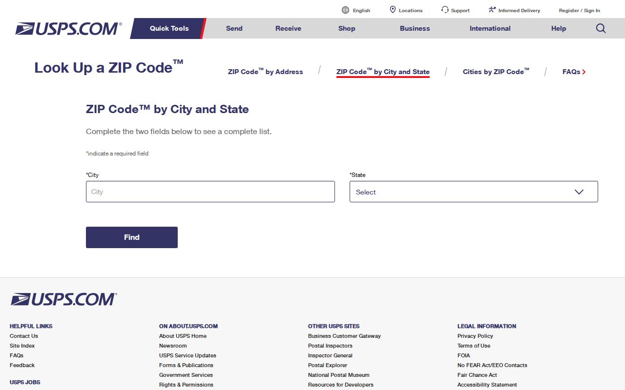
The form is a good first check, but the returned postal code must still be paired with county parcel data for local jurisdiction.
Find St. Cloud Residents by ZIP
Official systems do not all offer a simple ZIP-wide resident list. The practical method is to verify the mailing geography, choose a source that legitimately accepts a ZIP, and then confirm any named result in an independent record. A parcel roll is organized around land. A professional license record is organized around a license. A voter extract is governed by election law and request rules.
- Confirm the complete mailing address and current ZIP through USPS.
- Open the county parcel search or GIS and confirm the parcel jurisdiction. Use the parcel ID when the street spelling is unclear.
- Use a ZIP filter only where the official tool actually provides one. DBPR and the FDLE registry expose geography controls, while the public voter-status screen requires a name and birth date for a person’s own record.
- Compare a name with a second source before deciding that two results identify the same person.
- Once the search reaches one road, use the St. Cloud street directory for address-level methods.
This sequence narrows a large delivery area without pretending the ZIP itself names a household. Common names, trust ownership, out-of-area tax mail, and protected addresses can all break a quick match.
St. Cloud ZIP Search Tools
The Florida DBPR license search supports city and county controls and can help check a public professional or business affiliation. The result is not residence proof. It reflects the address and status associated with the license record.
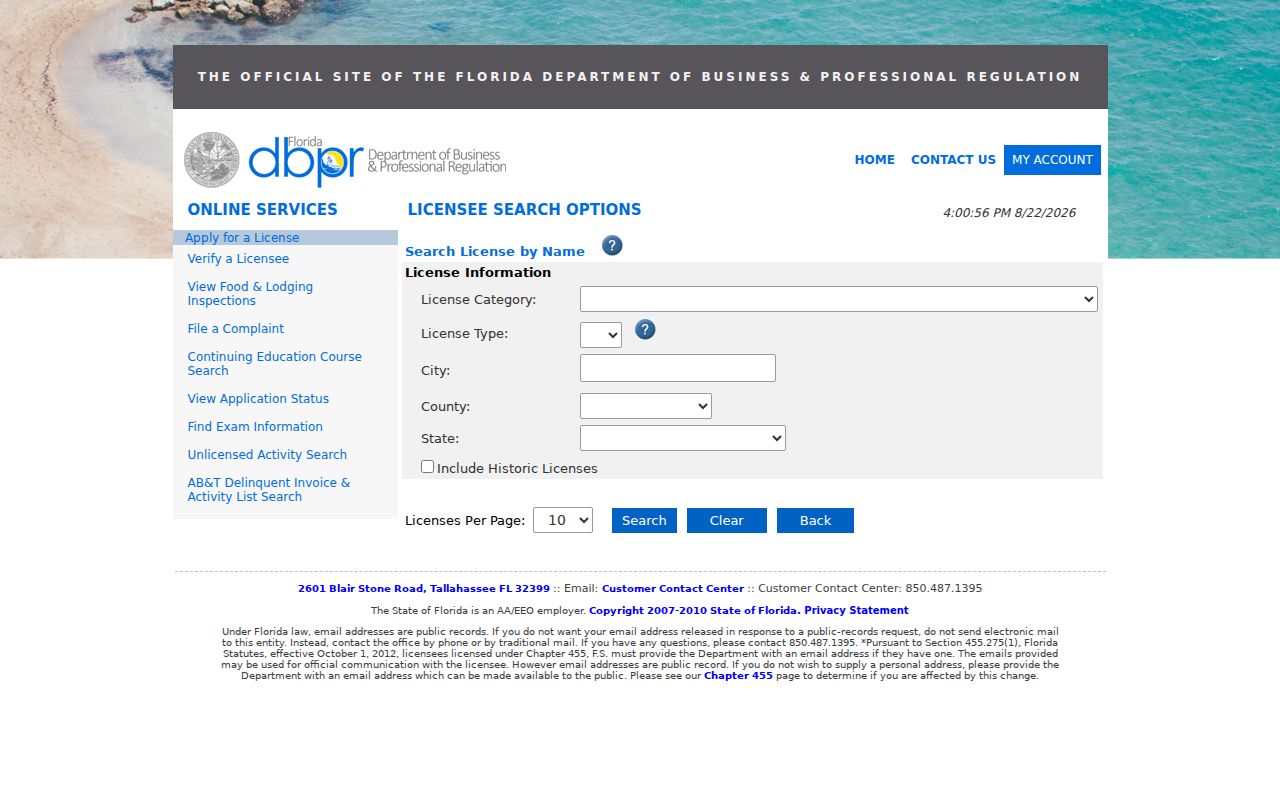
The captured screen illustrates why the field label matters. Search modes differ, and a city or ZIP field may describe a licensed location rather than a home.
| Official source | ZIP handling | What it can establish |
|---|---|---|
| USPS | Address or city/state lookup | Current postal formatting and delivery ZIP |
| Property Appraiser and GIS | Start with address or parcel; map geography | Parcel, owner roll, situs, and jurisdiction |
| DBPR | City, county, and location controls | License affiliation, status, and record address |
| Florida voter status | No public neighborhood browsing | Authenticated status for the voter’s own record |
| Voter extract request | Geographic fields subject to request rules | Lawfully released public election data |
St. Cloud Voter ZIP Limits
Florida separates the voter’s status tool from public-data requests. The Voter Information Lookup asks for first name, last name, birth date, and acknowledgment. It is designed for a voter to check an individual registration. It is not a St. Cloud ZIP code directory or a way to browse a block.
The Division of Elections voter extract process is the separate route for public fields and geography. Florida law protects Social Security numbers, driver-license or state-ID numbers, signatures, and qualifying protected addresses. The successful manifest capture summarizes the distinction between public and exempt voter address fields.
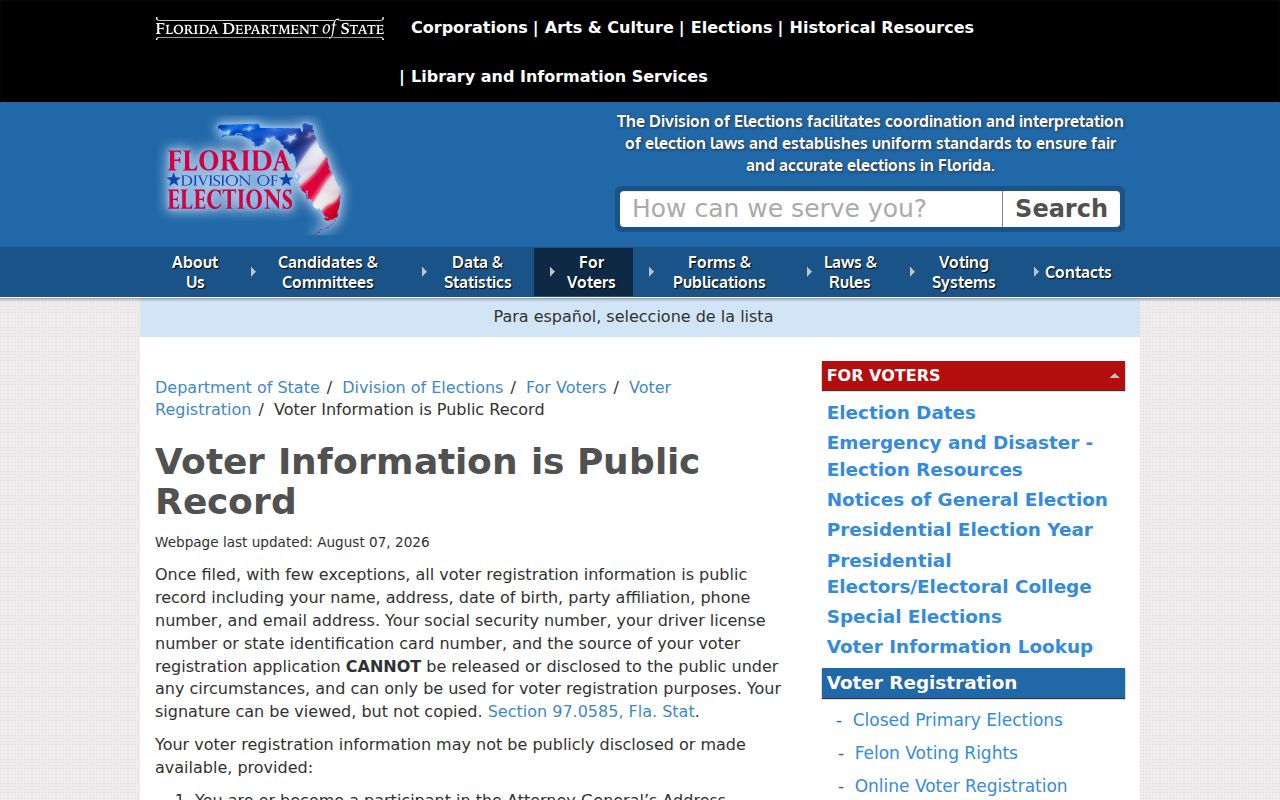
Use released data only for a lawful purpose. Never infer a concealed address or fill gaps with private household claims.
The separate Florida voter extract request explains the official route for requesting public registration data rather than using the own-record status screen as a St. Cloud ZIP code directory.
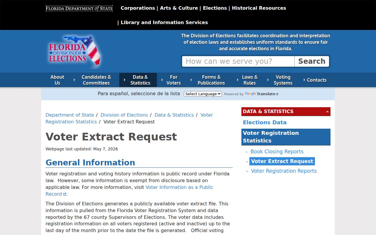
The request page is the proper starting point for available geography fields, current layouts, and release rules; protected fields remain exempt.
St. Cloud ZIPs and City Limits
A ZIP describes mail delivery. The incorporated City of St. Cloud is a legal boundary. Osceola County parcels, voting districts, service areas, and special districts are separate layers again. They can overlap without sharing an edge. This mismatch explains why a postal city cannot select the correct permit office by itself.
- ZIP code
- A USPS delivery geography, not a resident roll or municipal boundary.
- ZIP+4
- Four added digits that refine a delivery segment, often a side of a street, building, or group of boxes.
- PO-box ZIP
- A code that may be assigned to post-office boxes. The research did not verify one specific to St. Cloud.
- Unique ZIP
- A code assigned to one high-volume organization. No St. Cloud example was verified in the research.
- Carrier route
- A postal delivery path that can cross other civic or record boundaries.
Think of the process as four layers: mailing ZIP → parcel boundary → city or county jurisdiction → service or election district. The Osceola GIS viewer supplies parcel and available context layers, but its map is informational and not a survey.
Keep St. Cloud ZIP Claims Exact
The research did not locate authoritative government polygons for every St. Cloud ZIP, an official history of splits or realignments, or confirmed PO-box-only and unique codes. Those gaps matter. Third-party boundary drawings can be useful visual aids, but they should not be presented as the legal city line or as proof of where a person resides.
For one address, use USPS, then the Property Appraiser and GIS. For a public-data request, describe the desired existing fields, date range, and geography rather than asking staff to create a new directory. Florida Public Records Law, in Florida Statutes chapter 119, permits inspection and copying of nonexempt records. Fees and a special-service charge may apply when retrieval or review is extensive.
Note: Ask the custodian for an estimate and an electronic format before a large ZIP-based records request is processed.